Our 56th park visit along our quest to trek about all 59
of our country's major national parks.

August 17th - Sunset at Copper Harbor, MI the evening before departing for Isle Royale National Park - our 56th park visit!

Sunrise from atop Brockway Drive.

August 18th - Rock Harbor location map!

Isle Royale Queen IV - the transport vessel from Copper Harbor to Isle Royale.

Shoreline along Rock Harbor on our hike out to Scoville Point.

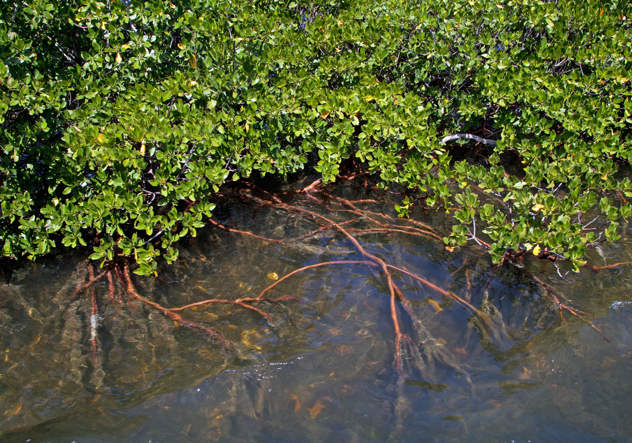
Driftwood along the coastal waterway.

Terry's one happy trekker!

Intriguing coastline as we hike to the tip of Scoville Point.


Almost out of real estate as Terry makes her way to the Point.

Enjoying the sunshine at Scoville Point. A 4.2 mile round trip loop from Rock Harbor most to the end of the trail.

Typical Isle Royale coastline.

Lovely sunset - August 18, 2016

August 19 - Trekking to the top of Mt. Franklin - a 10-mile hike.

Kayakers paddling Rock Harbor.

Avoiding the swampy grounds.

Terry checks out Suzy's Cave.

A smooch atop Mt. Franklin!

Time for lunch!

Lily pond but no moose!
We heard them in the woods but they did not present themselves to us!

More lilies on the pond! (Lake Ojibway)

August 20th - Edisen Fishery and Rock Harbor Lighthouse Tour.
A view of the fishery as we are about to dock.

Rock Harbor Lighthouse.

Fishery NET house.

Terry inside the Nut hou....er Net House!

Makeshift buoys.

About a half mile west of the Fishery you'll find the basecamp for the longest continuous study of a predator/prey relationship - the moose and wolves of Isle Royale. Pictured above is the wolf bone yard. Below, the moose bone yard.

NP#56 – Isle Royale National Park
Aug 2016- Getting
there! Isle Royale is located in Michigan. Actually, it’s located in Lake
Superior much closer to Canada and Minnesota than it is to Michigan; however,
somewhere along the way, the powers-to-be decided this island was a part of The
Wolverine State!
For our visit to our 56th
park, Terry has scheduled us to fly into Minneapolis-St. Paul via American
Airlines. We’ll be going “standby.” Not my favorite mode of transportation;
however, we had no problem getting a seat.
We land at MSP (code for the
airport) around 8:30pm. MSP is a very
large airport with a pretty decent hike to the rental car depot. We pick up our
Jeep and attempt to navigate out of the airport. That takes us two tries as the
little lady inside my phone who is giving me directions steers me back around
into short-term parking!
Once we escape the confines of MSP,
we're on our way to the Hampster (Hampton Inn) in Chippawa Falls. By the time
we reach Chippawa, all local restaurants have closed up shop. Dinner this
evening consists of microwave Veggie Lasagna and nasty cheap bottle of Merlot
we bought from the night shift guy at the Hampster.
8/17- The next
leg of our trek takes us from Chippawa Falls to Copper Harbor where we'll be
staying the night at the Keweenaw Mountain Lodge. Today’s drive to Michigan’s
UP (Upper Peninsula) will take us about 6 hours. Like Isle Royale, I’m not sure
how the UP became part of MI since this landmass is connected to WI!
Along the route, we stop at the
Isle Royale Visitor Center in Houghton, MI to get our park pin...just in case
the Visitor Center on the island doesn't have them. On our drive to Copper
Harbor, the northernmost point of the UP, we pass through the tiny town of
Phoenix! A tad smaller and a whole lot greener than home!
The Keweenaw Mountain Lodge sits
up on a hill about a mile south of the dock we will be departing from. We are
assigned Rm #29- a motel unit that will do the job of housing us for the night.
Dinner at the Lodge is surprisingly good! We/I had a decent Pinot to go along
with my Veggie Lasagna. Yep Veggie Lasagna two nights in a row!
At dinner, I discover that I had
misunderstood our departure time returning from Isle Royale on Sunday. I
thought Terry had told me we would be leaving the Island at 8 am, which would
get us back to the mainland at around 11:30am. Upon returning to Copper Harbor,
we would then make a 6-hour drive to Superior, WI before heading up to
Voyageurs. When I found out we would not be departing Isle Royale until 2:30 pm
(arriving Copper Harbor at approx. 6pm), I suggested we change or hotel
reservation from Superior, WI to the much closer Holiday Inn in Houghton, MI.
That proved to be easier said than
done! We soon discover that there is little to no cell service in Copper Harbor
and AT&T took out the pay phones years ago. The desk clerk at the Lodge
suggested we drive to the top of the nearby mountain where cell service can
"sometimes be available!"
After dinner, we hop into the
Jeepster and make our way up Brockway Mountain Drive in search of cell
service. “I’ve got one bar,” Terry
exclaims as we approach the summit of the mountain. She dials the Holiday Inn
and remarkably gets connected to a reservationist….for about 30 seconds. The
connection is lost before she’s able to finish changing our reservation!
“We need to get higher,” she
pleads….so off we go to the far reaches of Brockway Mtn Drive. “I’ve got
another bar!” Terry cries out. I stop the car and she dials the Holiday Inn
once again. Success! She gets through and is able to change our reservation. This
will prove to be a huge blessing four days from now.
With nothing better to do, we head
down the mountain to the coastline and find a spot to photograph the sunset.
The skies here in Copper Harbor are beautiful! After a productive photo shoot,
we discover a small shop that sells very tasty ice cream. We check out where we
will be departing tomorrow...then off to bed!
8/18- We’re up at
the crack of dawn (6am) to catch the sunrise. Another very productive photo op atop Brockway
Mountain! At 6:40a, we find a diner open and enjoy a decent breakfast. At 7:10,
we drive about 200 yards to the parking lot where we'll pay 30 scoots to park
our rental car before boarding the Isle Royale Queen IV, which is the vessel that
will transport us to Isle Royale.
Today, Lake Superior is
"flat." Barely a hint of breeze as the crew loads a dozen kayaks, all
the luggage and finally the 80 or so passengers they will be shuttling from
Copper Harbor to Isle Royale. As we will discover upon our return trip,
the lake can get a bit surly!
There are several transportation
options when visiting Isle Royale and driving there isn't one of them. You can
depart from Houghton, MI on the National Park Service vessel, which will take
about 6 hours to get to the island. You could opt to depart from Grand Portage,
MN on a boat that takes about 8 hours to get you to port. You could opt to take
a floatplane that will cost you about 300 scoots...and get you to the island in a half hour. Or you
could do as we did and take the 3 1/2 hour cruise on the Isle Royale Queen IV, which
departs from Copper Harbor.
Once on the island, you will find
no roads, cars or trucks. Just footpaths and waterways that will allow you to
experience this wilderness park in solitude.
After our island orientation, we
got checked into our housekeeping unit #220. We had a mediocre lunch before
taking the 4.2-mile Loop hike out to Scoville Point. We highly recommend this
hike if you visit Isle Royale. The first half of the trail takes you along the
rugged and rocky coastline and then out to the tip of the peninsula. This
section of the trail is called the Stoll Trail, named after William Stoll, who
was very instrumental in getting this hunk of rock set aside as a national park.
The return portion of the loop
takes you back to the lodge adjacent to Tobin Harbor. Rather than suffer
through another mediocre meal at the lodge restaurants, we opt to buy brats,
rice and a bottle of Ravenwood Zinfindel. Good vino! Terry even had a glass!
After dinner we listened to the
Ranger's presentation about how she has connected to the island. Terry fell
asleep as the ranger muddled through her slide show featuring none other than…herself!
Terry mentioned that they should require all rangers to attend a presentation
skills class before attempting public speaking engagements!
After the show, we wandered out to
the dock to take some sunset pix.
8/19 - Slept in
this morning. Today, we are off on a 10-mile hike to the highest point on the
island - Mt. Franklin. At an elevation of only 1080', I'm not sure Ben
Franklin's namesake actually qualifies as a mountain. Nevertheless, we begin
our trek a little after 10 o'clock. The first 2 miles of the trail take you along
the coastal Rock Harbor Trail. From there, we hiked up to Suzy's Cave (see
picture) before joining the western section of the Tobin Trail.
Just before heading up the trail
to the mountaintop, we heard a moose bugling. Shortly thereafter, we ran into
an older couple that had just encountered a Momma moose and her calf. The two
beasts apparently stood directly in their path, so the geezers chose to head
back to camp. I asked where the moose were in proximity to us and the
gentlewoman said “about 200 yards ahead off to the left!”
We chose to continue on in hopes
of catching a glimpse of these majestic mammals. The geezers must have
frightened the moose as momma and child had moved on by the time we had hiked
to their said location.
About a half-mile from the summit,
we wandered by what I called the Lily Pond. Along this trail I learned about
Thimbleberries...a reddish-pink berry that were in full bloom. Tasty little
morsels, I must have picked a hundred of them as we climbed and descended the
mountain.
The night before, we ordered a couple
of wraps from the restaurant that we intended on eating for lunch at the top of
the mountain. Like most of the food prepared by the Forever Resorts staff, the
wraps were barely eatable. Good thing we’d packed other goodies to munch
on. In particular, the Chocolate Brownie Cliff Bars were the best!
The hike to the top of Mt Franklin
proved to be the highlight of the day. For dinner we chose to experience the
Greenstone Grill. Much to our surprise, the Greek Pizza we ordered was actually
very good...as were the two beers I enjoyed! Plenty of pizza...enough for
leftovers for tomorrow's tour of The Rock Harbor Lighthouse and the Fish Camp.
8/20 - Slept in
again! Got outta our Jammie's around 7:10. Skies are cloudy this morning.
Forecast predicting showers later in the day. We pack our rain gear "just
in case." First order of business...breakfast! Yesterday, when I went to
get a cup of coffee and pick up our soggy wraps, the Greenstone Grill was
empty. Today it's packed! We get the last table!
Today we're scheduled to take the
Edison Fishery/Rock Harbor Lighthouse Tour. This is a four-hour trip from Rock
Harbor to the island's first lighthouse and one of its first fish camps. When
we checked into the Lodge on Wednesday, we asked the desk clerk to sign us up
for the Lighthouse tour. She told us "no need to sign up today. These
tours never sell out. Just sign up on Saturday morning. There will be plenty of
seats."
T'was a good thing I insisted
signing up the night before as the staff overbooked the trip! With a boatload
full of people, the Sandy chugs across Rock Harbor to our destination. We are
greeted by one of the park’s VIP's (Volunteers-In-Parks) who gives us a brief
history of the Edison Fish Camp. She then sends us on our way to the
lighthouse, which is about a quarter mile down the path and recommends we also
visit the base camp for the 50 year+ study of the relationship between the
wolves and moose on Isle Royale.
Inside the lighthouse, we learn
about the 15 ships that have sunk off the waters around Isle Royale. As I
mentioned earlier, Lake Superior isn’t always calm like it was on our passage
from Copper Harbor to Isle Royale. Gordon Lightfoot’s classic song, The Wreck of the Edmond Fitzgerald
exemplifies just how nasty Lake Superior can become!
After enjoying the lighthouse, we
explored the various buildings of the fishery before wandering down to the site
of the world's longest study of Moose-Wolf predator/prey relationships. These
people have spent the past several decades studying the dynamics of moose and
wolf on Isle Royale. Sadly, we learn that only 2 wolves remain on the island.
At one point, there were 50.
With the wolf population down to
next to nothing, the moose population has grown to over 1300. It’s come down to
a tough decision: Does the Park Service repopulate the island with new wolves
or allow them to go extinct on this isolated landscape? During an evening
lecture by the local Park Ranger, we learn that the NPS has been conducting
surveys and studies as to what should be done about the situation. At this time, there are four possible
solutions to the problem.
One option is to do nothing and
let nature take its course. Another option is to reintroduce a new set of wolves
like they did in Yellowstone a few years ago and then let nature take its
course. A third option is to reintroduce a small number of wolves periodically
over a series of years. The fourth option discussed is to reduce the moose
population so they don’t destroy the park’s ecosystem without reintroducing
wolves. There are arguments in favor of each of these options. Meanwhile, the
two remaining wolves may struggle to survive the upcoming winter.
Rain begins to fall as we depart
the wolf/moose study camp. Back to the Sandy (the name of the boat used for
this tour) to secure a seat under shelter. A handful of folks will ride back in
the rain!
Upon our return to terra firma, we
stop by the General Store and pick up a bottle of Ravenswood Zinfandel and a
$7.25 box of Triscuits. We play our favorite card game and watch the rain
gently soak the landscape. Rain! Soft, gentle rain. Unlike the brief and
violent downpours we get in Phoenix.
We didn't see any moose or wolves
on this trip. However, as we dined at the Lodge’s main restaurant, we did spot a
red fox running about the grounds with his dinner hanging from his mouth.
8/21 - Slept in
again! We awoke to scattered clouds. No rain today. After breakfast, we mosey
down to the Ranger Station only to find out that the Isle Royale Queen IV will
be several hours late due to high seas
and strong winds stirred up by last nights storm.
To kill time, we take a leisurely
2-mile stroll along the Scoville/Stoll trail. Upon our return, we noodle around
the Visitor Lounge. Terry discovers this area has Wi-Fi and finds a message
from Barb, our Dogsitter who is caring for CharlieDog while we are away. Terry
lets out a cry of anguish as she learns that C-Dawg has died!
Sadness cast a dark shadow over us
as we mourn the loss of our good friend and companion C-Dawg! He had a good,
long life and will be missed by many.
Our 2:30 departure time actually
ended up being 6:15. We won't be back to Copper Harbor until 10 pm. Good thing
we switched our hotel ressie from the Holiday Inn in Superior, WI to the
Holiday Inn in Houghton! It saved us a 5-hour drive on dark and windy
roads.
The winds had died down and the
seas have calmed a bit. Nonetheless, the boat ride back to the mainland proved
to be somber as we both reflected on the good times we had with our shaggy
canine, CharlieDog.
Random thoughts regarding: Isle Royale:
Isle Royale is pronounced with a
silent "e" as in Isle Royal. I refuse to call it anything but Royale!
There are two ways to get to Isle
Royale: (1) via boat, (2) via floatplane. If Lake Superior is feeling ornery,
you might want to consider the floatplane option. It will cost you $170 more;
however, you will save yourself a minimum of 6 hours travel time plus the
hassle of waiting for the crew to load and unload dozens of kayaks and canoes!
We were expecting bugs and humidity during our visit to the Isle. Not so much! It did
rain; however, the bugs never really bugged us. Apparently, the bugs take time
off in mid to late August.
If staying in a housekeeping unit
at Rock Harbor, plan on bringing your own food. Ignore the ship's 70 lb. max
luggage restriction. We saw people load hundreds of pounds of gear including
large coolers filled with food. The two
restaurants are decent, yet the housekeeping units are equipped with most
everything you’d need to cook up your own meals!
Best Housekeeping unit appears to
be #201. Looks like they have a view
of Tobin Harbor.
Trivia!
While reading the Keweenaw Traveler Newspaper at the Lodge, I came across an article about the origin of the saying "What the Sam Hill!" According to the legend, Sam Hill was a mining company agent during the Keweenaw copper mining boom in the 1850's. He was also a very proficient user of profanity! In fact, so colorful was his use foul language, he became famous for it! Sam Hill became a synonym for profanity!
When respectable people were about to blurt out an expletive, they substituted Sam's name instead. Those involved in the conversation instantly understood what that meant!